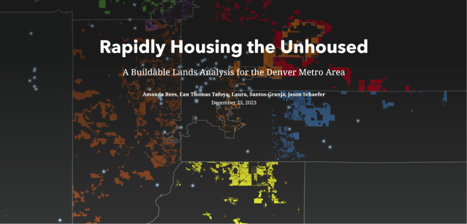
Where is it healthy to build housing in Metro Denver?
Why Buildable Lands?
We chose to pursue this research using a Buildable Lands model, which provides a methodology for determining parcels of land that are underutilized. Underutilized parcels are generally defined as those that have a current land use that does not match the allowable land use in the associated ordinance. We deemed this method appropriate because:
- it combines multiple layers of spatial data to tell a more detailed story
- It compares current condition with future condition
How is our Buildable Lands Study different?
Most Buildable Lands studies are aimed at understanding housing stock and land use underutilization, which is defined as parcels of land that have a greater capacity for development within the current land use code. In other words, a parcel is underutilized if it currently includes a single-family residence but is zoned for multi-family mixed use. The goal of our Buildable Lands study is to determine underutilized parcels, but in terms of healthy housing for the unhoused instead of housing density.
The Building Analysis Mapping Tool is read for use and can be accessed at this link.
Based on our analysis, about five percent of land in the seven county Denver Metro region is potentially available to house the unhoused population. However, the timeline of availability varies. Some of the parcels are vacant and may not include utilities or structures, while others have been improved with buildings or parking lots. Current tenure is also unknown. What this study shows, however, are the following key takeaways:
- There is potentially available land in each of the seven counties.
- The locations of potentially available parcels are spatially distributed around the metropolitan area.
- The largest number of parcels were eliminated due to land use and zoning compatibility, highlighting this as the largest obstacle in micro-community development.
A word from Ean Thomas Tafoya I have spent my career bringing people together to analyze and solve complex issues and I am a true believer in the Denver Inter-neighborhood Cooperation motto that Neighborhoods work best when people work together. This is equally true when it comes to regions. That our region works best when local governments work together. It is my hope that this tool can become a tool for calling out the myth that our housing crisis seems to be unsolvable and that we fulfill our moral obligation to immediately bring stability to the unhoused.
About the Researchers
Ean Thomas Tafoya, IRISE Visiting Community Scholar
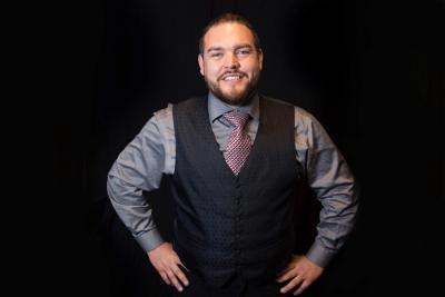
Ean is active in Denver Public Affairs, Colorado Public Policy, and Federal Environmental Policy. He has worked for three branches of local government, worked at three levels of American government, run for Denver Mayor, and has directed many local and state political races. Currently, he serves as the GreenLatinos Colorado State Director. Ean has received recognition for his work from the Denver Regional Council of Governments, the Denver Regional Air Quality Council, named a River Hero by the National River Network, and served as the Co-Chair of the Colorado Environmental Justice Action Taskforce. Recently, he was named a Top 10 National Energy Justice leader by Vote Solar and completed the National Renewable Energy Laboratory Energy Executives program. He loves to dance whether it be at a concert or in politics! As Mr. Denver, a local music DJ and radio host, he uses the media to uplift locals in the community. Follow Ean @eanthomastafoya on all platforms.
Ean is a water protector that holds a B.A. in Political Science with a Minor in Native American Studies, a Water Studies Certificate, and Early Childhood Education Certificate from Metropolitan State University of Denver as well as a Horticultural Therapy Certificate for Colorado State University. Currently, he is a Community Scholar at the University of Denver Interdisciplinary Research Institute of (in)Equality researching infrastructure, housing, and environmental justice.
Mandy Rees, Director of the Geospatial Analysis and Mapping Lab at CU Denver
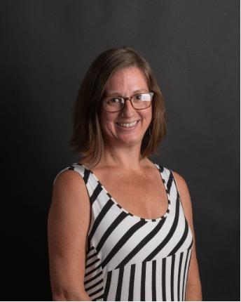
Mandy is an Historical Geography and Geospatial Scientist. Currently she is the Director of the Geospatial Analysis and mapping Lab at the University of Colorado Denver and a doctoral student in Geography, Planning and Design. Mandy’s research is focused on visualizing and analyzing the inequitable impacts of land use planning, specifically in terms of zoning, urban renewal and highway development.